
Navigation 101: Map, Compass, Confidence
Why Navigation Skills Still Matter
GPS devices and smartphone maps are incredibly useful, but they depend on batteries, hardware, signals, and sometimes internet access. A dead phone, damaged screen, drained battery, storm, or remote location can leave people surprisingly disoriented very quickly.
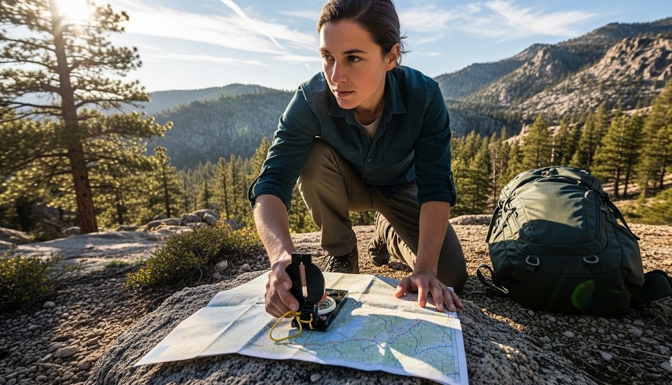
Basic land navigation skills provide independence when electronics fail. A map, compass, and calm decision-making process can help you stay oriented, avoid panic, and move safely toward known locations.
You do not need to become an elite wilderness navigator. You need enough skill to avoid getting more lost.
Objective
Learn practical navigation techniques using maps, compasses, terrain features, pace counting, and route planning so you can move confidently without GPS.
The Three Core Navigation Tools
Most basic land navigation relies on three simple elements:
- Map: shows terrain, roads, water, elevation, and landmarks
- Compass: helps maintain direction
- Observation: confirms where you are in the real world
Strong navigation comes from combining all three continuously instead of relying on only one.
Understand Terrain Before You Move
Before walking anywhere, stop and study the map carefully.
- Roads
- Creeks and rivers
- Ridges and valleys
- Hills and elevation changes
- Trails
- Power lines
- Lakes and open fields
These features help you build a mental picture of the terrain before you begin moving.
Orient the Map First
A map becomes far easier to use when aligned with the terrain around you.
- Lay the map flat.
- Use the compass to identify north.
- Rotate the map until map north matches real north.
- Compare visible terrain with the map.
Once the map is oriented, roads, ridges, rivers, and valleys become much easier to understand.
Using a Compass Bearing
A bearing gives you a precise direction to travel.
- Identify your destination on the map.
- Place the compass edge between your location and destination.
- Rotate the compass housing to line up with map north.
- Read the bearing.
- Turn your body until the compass needle matches the orienting arrow.
- Move toward a visible object in that direction.
Instead of staring at the compass constantly, choose a tree, rock, or landmark ahead and walk toward it.
Pace Count: Estimating Distance
Navigation is not only about direction. Distance matters too.
A pace count helps estimate how far you have traveled. Many navigators count every time the same foot hits the ground.
Your pace count changes based on:
- Terrain
- Elevation
- Snow or mud
- Fatigue
- Night conditions
- Heavy gear
Practice on known distances to learn your normal pace count under different conditions.
Terrain Association: The Most Practical Skill
Expert navigators constantly compare terrain around them to the map.
Ask yourself:
- Is the ground rising or falling?
- Where is the nearest water source?
- Does the terrain match the map?
- Should a ridge or creek already be nearby?
- Am I crossing expected terrain features?
Terrain association often prevents small mistakes from becoming major navigation failures.
Use Handrails and Backstops
Strong navigation plans use terrain intentionally.
- Handrails: terrain features you follow, such as creeks, roads, or ridges
- Backstops: large features that tell you when you have gone too far
Example:
- Follow a creek upstream until you reach a road.
- The road becomes your backstop.
This prevents wandering far past your target.
Attack Points Make Navigation Easier
Instead of navigating directly to a tiny destination, navigate first to a large obvious feature nearby.
That nearby feature becomes your “attack point.”
Example:
- Navigate first to a creek crossing.
- Then take a short precise bearing to camp.
Breaking navigation into smaller pieces reduces mistakes.
What To Do If You Think You Are Lost
Most navigation problems become worse because people panic and continue moving without a plan.
Use the STOP method:
- Stop
- Think
- Observe
- Plan
Sit down, calm yourself, drink water, study the map, and identify the last confirmed location before moving again.
Night and Bad Weather Navigation
Darkness, fog, rain, and snow reduce visibility and increase navigation errors.
- Move slower.
- Use shorter navigation legs.
- Confirm terrain features more often.
- Choose larger, easier-to-identify landmarks.
- Avoid unnecessary risk near cliffs, rivers, or steep terrain.
Sometimes the safest navigation decision is to stop and wait for better visibility.
Common Navigation Mistakes
- Walking while confused instead of stopping.
- Ignoring terrain that contradicts the map.
- Trusting GPS blindly.
- Failing to orient the map.
- Walking too fast.
- Neglecting distance estimation.
- Not identifying backstops.
Real Example
During a forest hike in low visibility, a group overshot a trail junction by several hundred yards. Instead of continuing deeper into unfamiliar terrain, they intentionally moved toward a nearby creek marked on the map. Once they reached the creek, they used it as a handrail to relocate the correct trail intersection safely.
Basic Navigation Kit
- Baseplate compass
- Printed local map
- Grease pencil or marker
- Notebook
- Headlamp
- Pace beads or simple counter
- Backup batteries for GPS or phone
Simple Practice Drill
Visit a local park or trail system with a printed map and compass. Choose three visible landmarks and practice:
- Orienting the map
- Taking a bearing
- Estimating distance
- Using terrain features as handrails
Repeat until the process feels comfortable under calm conditions.
Final Thoughts
Navigation confidence comes from practice, not expensive equipment. A simple map, basic compass, and calm thinking process can prevent small mistakes from becoming dangerous situations.
Start with easy terrain, learn to observe your surroundings constantly, and build navigation habits before you truly need them.
← Previous | All Articles | Next →