Resection & Triangulation: Finding Your Position
Why Position-Finding Matters
GPS is useful, but batteries die, phones break, screens crack, signals fail, and devices sometimes give confusing results. In a real navigation problem, knowing how to find your position with a map and compass can keep a small mistake from turning into a dangerous situation.
Resection and triangulation are classic navigation methods used to determine where you are by taking bearings to known terrain features. These skills are especially useful when you can see landmarks but are unsure exactly where you stand on the map.
The goal is not perfect survey accuracy. The goal is to shrink uncertainty enough to make safe route decisions.
Objective
Fix your position without GPS by identifying known terrain features, shooting compass bearings, plotting back bearings on a map, and confirming the result with nearby landforms.
Resection vs Triangulation
The terms are often used together, but they describe slightly different ideas.
Resection
Resection means determining your unknown position by taking bearings to known points.
You know where the mountains, towers, lakes, road junctions, or peaks are on the map. You do not know exactly where you are. By drawing lines from those known points back toward yourself, your location appears where the lines intersect.
Triangulation
Triangulation uses multiple bearings to create an estimated position area. With three good features, the lines usually form a small triangle. Your position is inside or near that triangle.
Smaller triangles usually mean better accuracy.
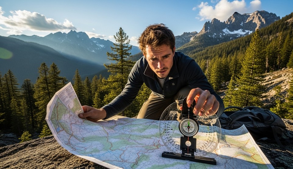
What You Need
- Topographic map
- Baseplate compass
- Pencil
- Straightedge or compass edge
- Map case or waterproof protection
- Declination information
A clear map and a reliable compass are more useful than expensive gear you do not know how to use.
Step 1: Stop and Stabilize
If you are uncertain about your location, stop moving before making the error worse.
Use the basic STOP method:
- Stop: Pause immediately.
- Think: Review your last known location.
- Observe: Identify terrain, landmarks, and hazards.
- Plan: Choose a safe navigation method.
Wandering while uncertain creates bigger search areas and more stress.
Step 2: Identify Known Features
Choose features you can clearly see in the terrain and confidently locate on the map.
Good Features
- Distinct mountain peaks
- Lakes
- Road junctions
- Towers
- Bridges
- River bends
- Prominent ridgelines
Poor Features
- Similar-looking hills
- Generic tree lines
- Unmarked clearings
- Small features hidden by vegetation
A wrong feature creates a wrong position. Feature selection matters.
Step 3: Take a Bearing
Point the direction-of-travel arrow on your compass at the known landmark.
- Hold the compass level.
- Aim carefully at the feature.
- Rotate the bezel until the needle aligns with north.
- Read the bearing.
Keep metal objects, phones, knives, vehicles, and electronics away from the compass while taking readings.
Step 4: Convert to a Back Bearing
To plot your position from the landmark back toward yourself, you use a back bearing.
Simple rule:
- If the bearing is less than 180°, add 180°.
- If the bearing is more than 180°, subtract 180°.
Example:
- 80° becomes 260°
- 230° becomes 50°
Step 5: Plot the Line on the Map
Find the landmark on your map. From that point, draw the back-bearing line toward your estimated position.
Repeat this process with two or three features.
Your location is near the intersection of the lines or inside the small triangle they create.
Two-Point Resection
Two-point resection can work when only two strong features are visible.
Use two features that are far apart from each other in angle. If the features are too close together, your lines may intersect poorly and create uncertainty.
After plotting both back bearings, confirm the result with nearby terrain.
Three-Point Triangulation
Three-point triangulation is more reliable because it gives you a position triangle instead of a single intersection.
- Choose three distinct features.
- Take bearings to each feature.
- Correct for declination if needed.
- Plot back bearings from each feature.
- Find the triangle formed by the crossing lines.
Your location is usually near the center of that triangle.
Declination Matters
Magnetic north and map north are not always the same. Declination is the angle difference between them.
In some regions, declination is small. In others, it can create serious errors over distance.
Use current declination information printed on the map or from a reliable updated source before your trip.
Confirm With Terrain Association
Never trust plotted lines blindly. Confirm with what you can see around you.
Ask:
- Am I on a ridge, slope, valley, or flat?
- Is there a creek where the map says there should be?
- Does the road direction match the map?
- Do nearby contours make sense?
- Are there handrails or backstops nearby?
Navigation confidence comes from combining compass work with terrain reading.
Common Sources of Error
- Misidentifying a landmark
- Forgetting declination
- Holding the compass near metal
- Plotting from the wrong map feature
- Using landmarks too close together
- Drawing sloppy lines
- Ignoring terrain clues
Small errors can create large position mistakes over distance.
Scenario Example
You are somewhere along a forested ridge under cloudy skies. The sun is not useful, and your phone battery is dead. You can see two distinct peaks and a lake outlet.
You identify all three features on the map, shoot bearings to each one, convert them to back bearings, and plot them. The three lines form a small triangle on the ridge you suspected you were following.
A nearby creek and contour shape confirm the position, and you safely choose the correct descent route.
Real Example
A hiking group lost confidence in their location after missing a trail junction in foggy conditions. When the fog lifted briefly, they used two peaks and a visible dam to triangulate their position within roughly 150 meters.
They then used the dam road as a handrail to reach camp safely instead of wandering deeper into broken terrain.
Resection Checklist
- Stop moving
- Identify visible landmarks
- Match landmarks to map features
- Shoot bearings carefully
- Correct for declination
- Plot back bearings
- Confirm with terrain features
- Choose a safe route from the fixed position
Practice Drill
Practice this skill before needing it in the field.
- Go to a local park or overlook with visible landmarks.
- Mark your actual position on the map but cover it.
- Take bearings to three known features.
- Plot back bearings.
- Compare your plotted position to your actual location.
Repeat until your position estimates become consistent.
Final Thoughts
Resection and triangulation are old skills, but they remain extremely useful. They give you a way to recover confidence when electronics fail or when your mental map no longer matches the terrain.
The method is simple: identify known features, shoot accurate bearings, plot back bearings, and confirm with terrain.
Practice turns the process from confusing map math into a dependable field skill.
← Previous | All Articles | Next →