Night Navigation by Stars & Moon
Objective
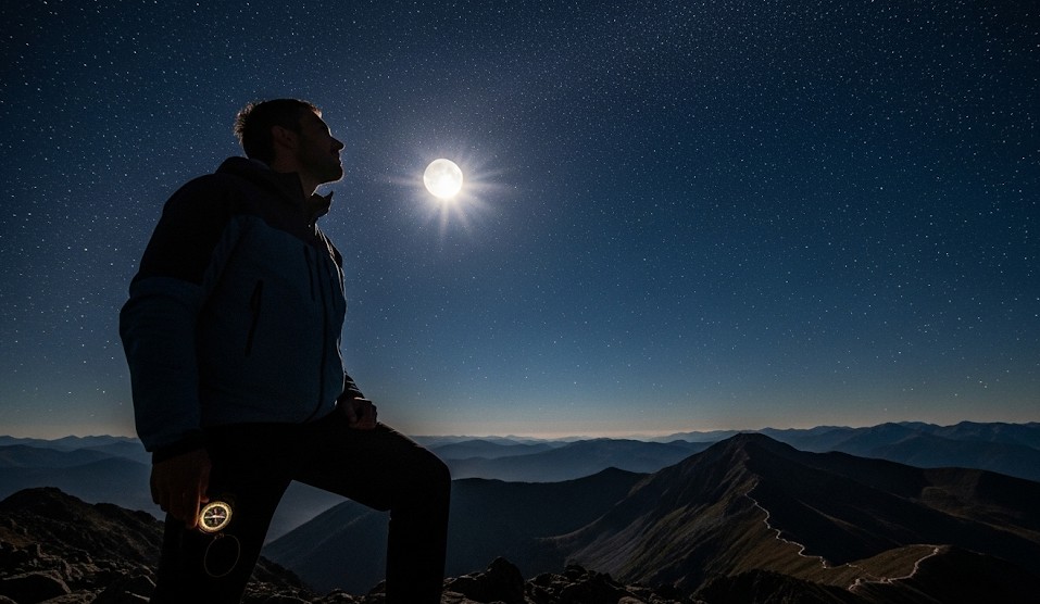
Night navigation is about maintaining direction, avoiding dangerous terrain, and moving safely after dark when visibility is limited and landmarks are harder to identify. The objective is to hold a bearing at night using the North Star, constellations, the moon’s motion, terrain features, and disciplined movement—without relying entirely on electronics.
Night travel can be peaceful and efficient in the right conditions, but it also increases the risk of injury, navigation drift, missed trail junctions, wildlife encounters, and poor decision-making caused by fatigue. The goal is not speed. The goal is steady movement with fewer mistakes. At night, confidence should come from method, not from the bold declaration that “this looks about right.”
Scenario (Example)
Example: You are above treeline on a clear night and must move from camp to a saddle northeast of your position before weather arrives. Electronics are unavailable or battery power must be conserved. The terrain is mostly open, but side slopes and rock bands could slowly pull the group off course if drift is not corrected regularly.
In situations like this, celestial navigation becomes a backup system for maintaining orientation. It works best when combined with terrain awareness, route planning, and conservative pacing. If you need daytime navigation fundamentals first, review Navigation 101: Map, Compass, Confidence .
Why Night Navigation Is Difficult
Human vision changes dramatically after dark. Depth perception weakens, colors fade, and terrain details disappear. Even familiar routes can look completely different at night. Small navigation errors compound because there are fewer visual references available to correct them.
Fatigue also becomes a major factor. People tend to walk toward visible features such as bright sky gaps, moonlight, or easy terrain instead of following the actual route. Side slopes can gradually pull a traveler downhill without them realizing it. In forested terrain, everything eventually begins to look suspiciously like “that same tree from ten minutes ago.”
Night navigation should be slower, more deliberate, and more conservative than daytime movement. Increase navigation checks, shorten travel legs, and avoid dangerous terrain where a small mistake could become serious.
Protect Your Night Vision
Dark adaptation takes time. Bright white light destroys night vision quickly and can make navigation harder for several minutes afterward. Preserving night vision improves your ability to spot terrain features, trail markers, silhouettes, and stars.
- Use a red-light headlamp mode when practical.
- Avoid staring at bright screens or flashlights.
- Dim maps, GPS units, or phones if they must be used.
- Pause briefly after turning off bright light to let vision recover.
- Keep one eye partially closed if sudden bright light is unavoidable.
Move carefully. A slower pace at night is normal and often safer. Save the dramatic sprinting through the forest for movies where nobody apparently twists an ankle in the dark.
Finding North in the Northern Hemisphere
The North Star, Polaris, is one of the most useful celestial navigation references in the Northern Hemisphere because it remains close to true north. It does not sit directly overhead unless you are at the North Pole, but it moves very little compared to other stars.
- Locate the Big Dipper constellation.
- Identify the two “pointer stars” at the end of the dipper bowl.
- Draw an imaginary line upward through those stars.
- Extend the line roughly five times the distance between the pointers.
- The bright star you reach is Polaris.
Once Polaris is identified, you can orient yourself and set a line of movement. Periodically stop and recheck the star to correct drift caused by terrain, fatigue, or side slopes.
Polaris is most useful for general direction rather than precision land navigation. It helps maintain a broad heading, especially in open terrain, snowfields, deserts, or above treeline travel.
Southern Hemisphere Navigation
In the Southern Hemisphere, Polaris is not visible. Instead, navigators often use the Southern Cross constellation to approximate south.
- Locate the Southern Cross.
- Extend the long axis of the cross roughly 4.5 times its length.
- Use Alpha and Beta Centauri as supporting “pointer” stars.
- The extended point indicates approximate south.
This method is less exact than Polaris but still useful for maintaining general orientation. Practice identifying the Southern Cross before relying on it during travel.
Using the Moon
The moon can provide directional clues, though it is less reliable than Polaris because its position changes constantly throughout the night and month. Still, understanding its motion can help maintain orientation.
- The moon generally rises in the east and sets in the west.
- The moon moves across the sky over time, so direction checks must be updated.
- The illuminated side of the moon faces the sun.
- The “horns” of a crescent moon point roughly away from the sun’s position below the horizon.
Moonlight can also improve terrain visibility, especially on open ground, snowfields, beaches, or ridgelines. However, bright moonlight can create deep shadows that hide holes, rocks, roots, and drop-offs.
Terrain Handrails and Night Movement
Terrain features often matter more than stars. A ridgeline, stream, trail, fence line, shoreline, or valley edge can serve as a “handrail” that helps maintain direction even when visibility is poor.
- Identify handrails during daylight whenever possible.
- Use large terrain features instead of relying only on tiny details.
- Check behind you occasionally so the return route looks familiar.
- Avoid cliff bands, steep scree, avalanche terrain, and dense brush after dark.
- Pause often to confirm direction rather than drifting slowly off route.
If clouds move in and celestial references disappear, terrain navigation becomes critical. In some situations, stopping and waiting for daylight is the safest option.
Pacing and Direction Control
Night movement should be broken into shorter navigation legs. Instead of trying to hold a direction for an hour, move to a visible landmark, stop, confirm position, and continue.
- Choose a visible target such as a tree, rock, or skyline feature.
- Walk to it, then select the next target.
- Recheck direction every 5–10 minutes.
- Slow down on side slopes where drift is common.
- Use group communication frequently.
Fatigue increases navigation errors. If the group becomes exhausted, cold, or confused, stop and reassess. For cold-weather movement concerns, see Cold Weather Survival Basics .
Clouds, Weather, and Backup Plans
Stars and moonlight can disappear quickly when weather changes. Never depend entirely on celestial navigation without a backup plan. Terrain, map work, pacing, route notes, and conservative decision-making should all support your movement.
- If clouds move in, switch to terrain handrails or stop travel.
- Avoid committing to cliffed or dangerous terrain at night.
- Mark camp or important locations clearly before leaving.
- Carry extra insulation and emergency shelter in case movement slows.
- Use daylight to identify bailout routes whenever possible.
If you must stop unexpectedly, know how to build shelter quickly. Review Building a Shelter from Natural Materials for emergency shelter concepts.
Wildlife Awareness at Night
Many animals are more active during dawn, dusk, and nighttime hours. Reduced visibility increases the chance of surprising wildlife at close range.
- Make moderate noise in dense brush or near streams.
- Use headlamps carefully to scan ahead.
- Avoid running at night on wildlife-heavy trails.
- Keep food secured away from sleeping areas.
For encounter prevention and animal behavior awareness, see Avoiding Dangerous Wildlife Encounters .
Real Example
A hiking team crossing open alpine terrain after sunset used Polaris to maintain a northeast heading toward a saddle above camp. Every 5–10 minutes they stopped to verify direction because a side slope kept pulling them east. By combining celestial navigation with terrain checks and shorter movement legs, they avoided drifting into steeper terrain below the ridge.
Common Mistakes
- Moving too fast after dark.
- Relying entirely on the moon without tracking its movement.
- Ignoring side-slope drift.
- Using bright white light constantly and destroying night vision.
- Continuing movement when exhausted or confused.
- Crossing dangerous terrain that would be avoided during daylight.
- Failing to identify landmarks before sunset.
Checklist
- Red-light headlamp with spare batteries
- Warm layers and rain protection
- Map and compass as primary backup tools
- Small notebook with route notes or bearings
- Emergency shelter or tarp
- Water and quick snacks
- Reflective markers or trail tape where legal and appropriate
- Backup navigation plan if clouds move in
Contingencies
- Clouds cover stars: switch to terrain handrails or stop travel.
- Fatigue increases: shorten navigation legs and increase checks.
- Group separation risk: tighten spacing and improve communication.
- Cold conditions: stop early and shelter before coordination drops.
- Terrain becomes dangerous: wait for daylight rather than forcing movement.
If you become stranded or must attract attention after dark, review Signaling from Remote Locations Without Electronics .
After-Action
Practice locating Polaris, the Southern Cross, and major constellations on clear nights before depending on them during real travel. Test your ability to hold a direction for short distances and then verify accuracy with a map or compass later.
Night navigation is a skill built through repetition, patience, and disciplined movement. Slow down, preserve night vision, use the sky as a reference—not a magic answer—and remember that arriving slightly later is usually preferable to starring in your own accidental nighttime survival episode.
← Previous | All Articles | Next →