Navigating Without Map or Compass
Objective
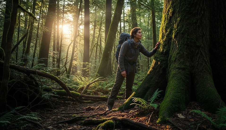
Losing a map, compass, phone, or GPS does not automatically mean you are helpless. The objective is to keep a reliable sense of direction by reading terrain, sun movement, water flow, wind clues, landmarks, and large natural features. These methods are less precise than proper navigation tools, but they can help you avoid wandering in circles and make better survival decisions.
The first rule is to stop the panic spiral. People who realize they are lost often keep walking faster, hoping the next ridge, bend, or clearing will magically fix the problem. That usually turns a small navigation error into a larger search area. Slow down, observe, identify what you know, and choose a deliberate plan.
If you still have basic tools and want a stronger foundation, review Navigation 101: Map, Compass, Confidence . Tool-free navigation is useful, but it should be a backup skill, not your first choice.
Scenario (Example)
Example: You lose your map in rolling hills. Clouds are moving in, your phone battery is nearly dead, and you need to return to a known road that runs east to west somewhere south of your position. You remember crossing a creek earlier, and the late-day sun is still visible for short periods between clouds.
In this situation, the goal is not perfect navigation. The goal is to avoid random wandering and move toward a large, reliable feature. If the road truly runs east-west and lies south, then identifying general south and using a creek, ridge, or drainage as a handrail may help you reach a backstop.
Stop, Think, Observe, Plan
Before moving, take a few minutes to organize your situation. This pause can prevent hours of wasted travel.
- Stop walking and calm your breathing.
- Think about your last known point and direction of travel.
- Observe the sun, slope, water flow, wind, tracks, trail signs, and landmarks.
- Plan a short movement leg instead of committing to a long unknown route.
- Mark your current location before leaving it if possible.
Use sticks, stones, tape, or natural markers to show where you changed direction. If you need to backtrack, those markers can prevent confusion.
Direction Without Tools
Natural direction methods are approximate. Use several clues together rather than trusting one sign completely.
- Sun: The sun generally rises in the east and sets in the west, though exact positions vary by season and latitude.
- Watch method: In mid-latitudes, an analog watch can help approximate north-south when the sun is visible. Point the hour hand toward the sun and bisect the angle between the hour hand and 12 o’clock, adjusting for daylight saving time where needed.
- Wind and weather: Prevailing wind can help only if you already know regional patterns. Do not rely on it alone.
- Terrain: Ridges often run in recognizable systems. Valleys and drainages frequently lead toward larger streams, roads, farms, or settlements.
- Water: Small streams usually join larger streams. Following water downhill can help, but it may also lead to cliffs, dense brush, swamps, or dangerous river crossings.
At night, stars and the moon may help maintain direction. For after-dark methods, see Night Navigation by Stars & Moon .
Handrails & Backstops
A handrail is a long feature you can follow, such as a stream, ridge, road, shoreline, fence, powerline, or valley. A backstop is a large feature that tells you when to stop, such as a road, river, lake, cliff line, or major trail.
Good improvised navigation often means choosing one handrail and moving along it until you reach a backstop. This is much safer than walking blindly on a guessed bearing.
- Use a creek, ridge, or trail as a handrail.
- Identify a large backstop before moving.
- Avoid crossing your handrail unless the plan requires it.
- Check progress every 10–15 minutes.
- If the feature becomes dangerous, stop and reassess rather than forcing it.
For example, if you know a highway runs east-west south of you, moving generally south until you hit that road can work as long as you are confident in the road’s location and there are no major hazards between you and it.
Terrain Association
Terrain association means matching what you see on the ground with what you remember about the area. Even without a map, you may remember that the trailhead was downhill from camp, that the road followed a valley, or that a large ridge was west of the route.
- Look for unique landmarks such as cliffs, saddles, towers, lakes, clear-cuts, or large bends in streams.
- Notice slope direction and whether you are climbing or descending.
- Use sound clues such as roads, rivers, machinery, aircraft, or people.
- Watch for human signs like cut logs, old roads, blazes, footprints, fences, or trash.
Sound can be misleading in mountains, canyons, wind, and forests, so do not chase it recklessly. Use it as a clue, not a command.
Tracking Your Movement
Once you start moving, track your direction and distance roughly. Even simple methods help.
- Choose landmarks every 10–15 minutes and look back at them.
- Place small stones in a pocket to count pace segments or time blocks.
- Note major turns, creek crossings, ridges, and clearings.
- Keep the group together and agree on each decision point.
- Avoid “just a little farther” wandering when tired.
If you realize the plan is not working, stop early. Continuing out of stubbornness can make rescue harder.
When to Stay Put
Sometimes the best navigation decision is to stop moving. If people know your route, daylight is fading, weather is worsening, or someone is injured, staying near a visible location may be safer than continuing.
- Stop if you are injured, exhausted, or hypothermic.
- Stop if nightfall is near and terrain is hazardous.
- Stop if weather removes visibility and you have no reliable handrail.
- Stop if you are making repeated direction changes without confidence.
- Build shelter and signal if rescue is likely.
If stopping becomes the plan, make yourself visible. Review Signaling from Remote Locations Without Electronics for ways to attract help without powered devices.
Hazards of Following Water
Following water downhill is a common survival suggestion, and it can work in some areas. Streams may lead to trails, roads, farms, rivers, or settlements. But water can also lead into dangerous terrain.
- Streams may drop into waterfalls, gorges, or steep ravines.
- Riverbanks may become thick with brush and slow movement.
- Wet rocks increase slip and injury risk.
- Crossing water can create cold exposure and drowning hazards.
If a route requires crossing a river or creek, review How to Cross a River Safely before committing to the crossing.
Desert and Open Terrain
Open terrain can feel easier because visibility is better, but it also creates heat, dehydration, and distance-estimation problems. Landmarks may appear closer than they are. Mirage, glare, and lack of shade can affect judgment.
In desert environments, water and shade may be more urgent than aggressive movement. For more detail, see Desert Survival: Water and Shade Priorities .
Real Example
A hiker lost the trail in rolling terrain and could not find the map. Instead of continuing randomly, they stopped and reviewed what they remembered: a service road ran near the lower drainage, the trailhead was west of a creek, and the late-day sun was visible through breaks in the clouds. The hiker followed a descending creek cautiously until reaching the service road, then turned west using the sun as a rough guide and returned to the trailhead before dark.
Common Mistakes
- Walking faster after realizing you are lost.
- Changing direction repeatedly without marking turns.
- Trusting one clue, such as moss, wind, or a vague memory.
- Following water into dangerous terrain without reassessing.
- Continuing after dark without clear handrails or lighting.
- Separating from the group to “search faster.”
- Failing to stop and signal when staying put is safer.
Checklist
- Mark your current location before moving
- Identify landmarks every 10–15 minutes
- Use handrails such as ridges, streams, roads, or shorelines
- Choose a backstop before committing to movement
- Track turns and distance with time, pace, or pocket stones
- Agree on a safe bailout direction with the group
- Stop before exhaustion, darkness, or weather removes options
Contingencies
- Fog or overcast: Shorten movement legs and stay on one feature you can touch or clearly follow.
- Nightfall: Stop unless you have clear handrails, safe terrain, and reliable lighting.
- Injury: Stop movement, stabilize the person, and prepare signals.
- Heat stress: Prioritize shade and water before continuing.
- Cold conditions: Shelter early and avoid sweating through layers.
After-Action
Practice the sun and watch method on clear days so it becomes familiar before clouds move in. During normal hikes, pause occasionally and ask yourself where the nearest road, stream, ridge, and trailhead are. This builds terrain awareness before you need it.
Navigating without tools is not about pretending you are immune to getting lost. It is about slowing down, using large features, avoiding panic decisions, and making each movement count. The woods do not hand out participation trophies, but they do reward people who stop walking in circles like a confused screensaver.
← Previous | All Articles | Next →